
We talked about going on down to the lake to feed the fish or skip rocks then had the revelation that they are MUCH closer to Bankhead than we are-why not just take the hike as planned?
On Friday, I had sent her a series of cryptic clues to find the Caspey trailhead involving close guesses via google maps, suggestions for landmarks 'park in the pull off with the most trash' and 'walk until you see a yellow sign'. Then, drop off the side of the hill and listen for water. With your toddler and 5 year old in tow. Then I ran for the state line with Gina and Suzette for the rest of the day.
They made a REALLY good go of it. They parked near the right place (which had been magically cleaned up!) and walked down a log road looking for the sign. They dinked around a while in the area and generally enjoyed hanging out, but did not get to the falls.
So, off we went, it was 4 in the afternoon, we had 3 hours until sunset. We got to the trailhead by 4:30 and they confirmed it was very close to where they had parked. We headed out, I had not been thinking 'short person' when I walked it last week, the stickers poked their 5 year old a few times. She was tough about it, though and did not let that slow her down much!
We walked straight to the stream along our newfound trail and it was SO much faster. I think I said the walk out was 1.5 miles. It's closer to a half mile-probably less. hahahaha! The original hike IN was so long, I assumed the walk out was the same distance. We did 4 miles last Sunday, this time it was not even 2.
It had been raining, but the feeder creeks were only up a little. You have to cross back and forth because the bank will be flat on one side and a sudden cliff on the other.

The T junction of the creeks below, I still love this unusual convergence.


 |
| The kids had dashed ahead and then sat and waited at the top of the falls. |
The adults and littles were on the other side of the creek from the big kids. We headed on down the trail planning to drop off and walk to the base of the falls the way we had the week before.
We did not count on the larger creek being SO full!
Everyone else turned around, I kept going to see the falls, certain they would be AMAZING with the water flow.
We did not count on the larger creek being SO full!
Everyone else turned around, I kept going to see the falls, certain they would be AMAZING with the water flow.


 |
| I gave up on staying dry, by the time I was back at the van I was soaked through and muddy! YES! I still have not had my 'first best day' of the year this year. |
I fell off a very short bluff into the creek, there was no getting back the way I came. So I climbed up the cliff by the falls, which was not too hard but was scary because I did not want to step on a saturated bit of footing and go off in the creek. Water closing over the top of my head skeeves me out and if I think about it happening in a situation involving falling off a 15 foot cliff first, I can freeze myself up, which is USELESS. I kept telling myself I had my waterproof camera. So to be sure to push the shutter as I fell, no need to waste a chance like that.
I rejoined the group, Sammy was not far behind because he had waited to help me back out. If I had known that, I could have avoided the whole 'cliff dangle' part of the day. Matt was with the baby, of course. I am not sure if it's good to be married to the person whose name would be on the short list to investigate if a friend's child came up missing or not.
I rejoined the group, Sammy was not far behind because he had waited to help me back out. If I had known that, I could have avoided the whole 'cliff dangle' part of the day. Matt was with the baby, of course. I am not sure if it's good to be married to the person whose name would be on the short list to investigate if a friend's child came up missing or not.
I was just sure I had caught him carving a tree!


Macro lichen shots. *snooze*

Black yoga pants are not the greatest for showing just HOW wet and muddy I was, but check out how the low light (it was nearly dark) made them pixelated in camera! Minecraft pants!
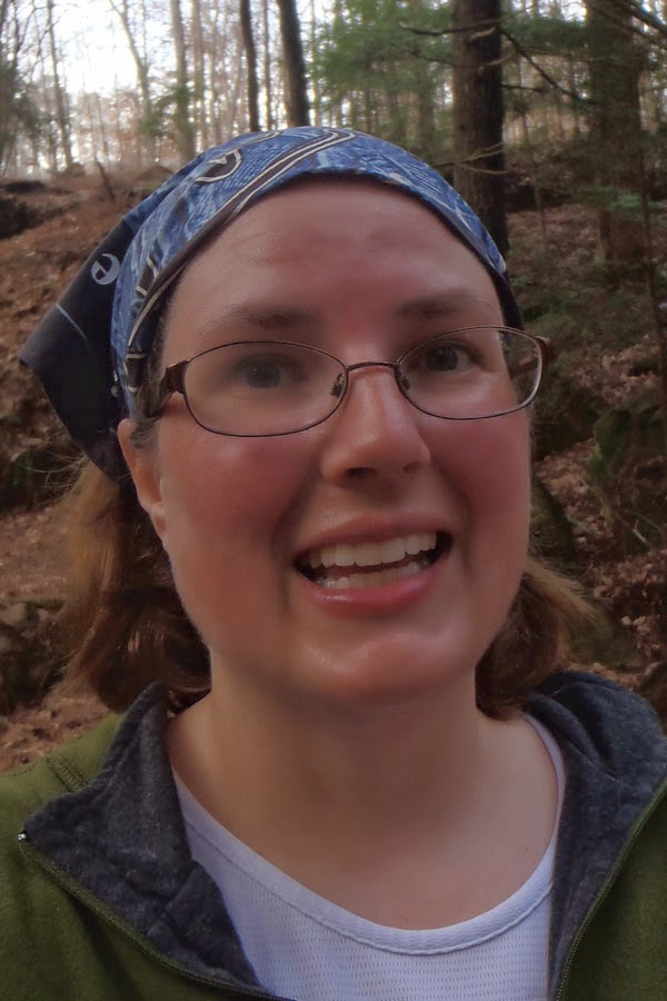
Me! So hot! Check my fogged glasses and sheened skin. That's calories on fire, baby.

Not at all sure why I took this one, but it's rare he smiles at me, so I am keeping it.
 |
| Heart shaped mossy rock! SCORE |

It actually rained on us a couple of times, but closer to water the hemlocks keep you dry when it's just sprinkles. When we got back to our cars the road was standing in water and the cars were dripping.

The hike out is steep, but better than wading through briars and climbing over downed trees!
We saw Elan (and his BRIGHT ORANGE) backpack and Benner head up the trail ahead of us, so we headed out as well assuming the other kids were ahead of them. Neither of the boys are renowned for their blinding speed on trails.
Nearly to the cars, Curry (the puppy) came up from behind us which meant Jake, Chan and Rho were BEHIND us, too. How far behind? Who knew! Chan was the only one who had been here before and it was almost dark. Luckily Sammy has a yell that covers a good mile in heavy trees. They heard him and headed our way. Later Chan told us they were going up a hill in the wrong direction. That's only terrifying, Bankhead is gigantic.
Nearly to the cars, Curry (the puppy) came up from behind us which meant Jake, Chan and Rho were BEHIND us, too. How far behind? Who knew! Chan was the only one who had been here before and it was almost dark. Luckily Sammy has a yell that covers a good mile in heavy trees. They heard him and headed our way. Later Chan told us they were going up a hill in the wrong direction. That's only terrifying, Bankhead is gigantic.
 |
| You can barely see them? I KNOW |
The kids have day packs and whistles and emergency gear, but we did not bring anything with us. This was a good reminder that those are still a good idea to have, even if they are not little any more. I am going to also add their own purification system to their packs. No need to let a good night lost in the woods give you giardia. A personal filter is cheaper than a doctor co-pay.

We headed our separate ways after the hike. I was wet and chilly and we still had to stop for dog food.
I took a few over exposed shots to show the fog that was filling in the valleys around us making it all ghosty! It's SO pretty in Bankhead, every time we go I wonder why we don't go more.


We planned a few days trips and camping trips, I am STOKED. It's about outdoor all the time time!! That magical week in the south where it's not too cold and not too hot!


