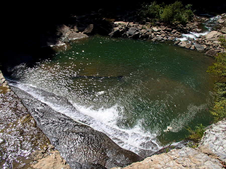
With temps in the 90's and heat index bumping the 110 area, I decided to run for the hills and the kids were ready to jump on the bandwagon.
Monday, I got my brakes done and the van checked out. Went to lunch with Jake and loaded up on various types of shelf stable drinks and snacks.
Tuesday, we headed out bright and early!
We went to South Cumberland first because we had an orienteering class that Park was teaching.
I still need about 2 more hours of patient telling and retelling about using a compass, but I have the gist of it now. Ben, of course, picked it up immediately.
Park hung out with us afterward and gave us a list it would take the rest of the year to finish of places to go see. Sometimes he's super useful with the ideas, sometimes he's too much like me-all over the place.
We headed more or less toward Ocoee, then decided to go further north and end up back there later in the week. We stopped for cheese at Philadelphia and backtracked to Tellico Plains. The plan was to go to the bald and camp, then get up Wednesday and head for the Smokies. Ben wanted to backpack to a campsite we have been eyeballing a while.
Stopped at Tellico River to walk around a bit and there was a snake on the trail to the water.
We did a last-minute detour to Bald River Falls, then decided to keep going the back way to Cherohala.
On the North River Road
The dispersed camping sites along the drive proved to be too tempting and we decided to stop where we could hear the water all night. After getting set up here, the kids went for a walk and decided the NEXT site up was even better. I was already in my hammock at that point, so we didn't move. Just made a note for next time.
Ben does not like hammock camping, so he got to use my new tent. Not having slept in several of my previous attempts at finding the right one, he was not as amazed as I still am over the Copper Spur.
I woke up really early and started packing my stuff up and grabbed some breakfast and water. I walked around a while and Ben got up, Chandler finally woke up and we got everything back in the van to get moving!
The previous campers did a decent job of trashing the site up, there was trash in every fire ring and scattered around on the ground, lots of scarred trees and partially burned wood. It's sad when people will take such a beautiful-and free-place and just take a crap on it like that.
Well, get moving after a little music.
All set up in the van, I turn the key and 'click, click, click'.
DANG.
There was a campsite a mile back that had people the night before, so we walked down to it. Their camper door and truck doors were WIDE open. I yelled 'Hello!' a few times and we looked up and down the creek and...nothing. Bears ate them.
We walked back up to our site and decided to leave a note on the car parked at the Donley Cabin trailhead, about 1/10th mile away. It said where we were, that the van had a dead battery and we had no cell service. If they got the note and could help, we would be very grateful.
Back at the van again, we packed water and a snack and the map. We were going to walk the few miles to the North River camping area. We had been at the campsite for about 15 hours at this point and the only car we had seen had been just after dawn, likely headed to trout fish.
Passing the Donley Cabin, the car that was parked there had left! They were from Indiana and I sincerely wished them a flat tire on the way home.
We got past the wide-open and still abandoned campsite and down the hill a ways and a truck was coming! It tried to go past us, but I yelled, "WE NEED HELP!"
It contained 2 older ladies, a little girl and several huge boxes of Bojangles. They had jumper cables, but the woman driving was so clueless about using them that she tried to give them to me and leave. They finally agreed to drive up to help us and took off, with us walking BACK up the hill to camp. We rounded a curve a bit later and they had stopped and sheepishly offered us a ride. We climbed in the back and enjoyed the ride!
 |
| this is my enjoying face |
We hooked up the cables, I talked the kids through it and Ben did all the clipping.
The boy loves a problem he can fix with his hands and his brain.
The van cranked immediately and we thanked them profusely and gave back the cables.
Since our destination, our favorite bald, was FURTHER up the long dirt road and I didn't know if the battery was bad or WHY it had gone dead, we decided to go back to Tellico Plains to get it checked.
Passing the horse camp a third time, men were milling around outside. I guess bears didn't eat them after all, but seeing a woman in distress obviously caused them to hide so I don't know which is worse. They must have been from Indiana.
The nice man at the NAPA place hooked it up and it tested 'good'. Still not sure why it went dead-we did not have anything plugged in and I had turned the lift gate and overhead lights off so they would not be on the whole time we were unloading and loading the van.
Since we were already there...we ate lunch at Tellico Grains and bought fougasse to have with our cheese.
Stopped to enjoy the river on the way out and the only pic I took was this dead bug.
We talked it over and decided to go over the Skyway anyhow, planning to end up at maybe Deep Creek to camp. That area anyway.
We stopped at several overlooks and finally at Huckleberry Knob, which has long been a favorite spot. We had planned to go here to watch the eclipse, but heard from a local that over 18,000 other people have had the same idea! DANG. So that little plan has changed...
I love the balds.
The hike is about a mile one way, it goes uphill (but not a hard climb, about 100-foot elevation gain) a long ways to Oak Knob, a lovely bald tucked into a high gap. After crossing it, the trail climbs another 100 feet through the woods and pops out on the higher bald, with VIEWS everywhere.

You can see Huckleberry up at the top of the far hill.
The balds are mowed once a year to keep them open.
Turk's Cap lilies
We were calling these pumpkin orchids because we didn't know what they were! After discovering the name, we decided we like pumpkin orchid more.
teeny Chan
That's Oak Knob and off on the other mountain top is Hooper Bald, which has no view anymore, the trees have filled in the edges.
Chestnut tree
I think Oregon Trail every time I see this view!
Much of the trail is in the woods, but the open part is waist high.
We did not get a single tick, though I am not sure how!
Another overlook, toward the Smokies
We stopped in a Joyce Kilmer to hike the lower loop, but after arriving, the bugs were BAD and it had just rained and it was humid and damp and we just walked to the bridge and back instead.
Hmmm
Between Joyce Kilmer and Robbinsville are many, many campsites! Some are tucked along the lake and there's a beautiful tiny campground right next to a creek that we stopped and checked out seriously before deciding it was just too wet there-and hammock camping would be hard because the sites were so teeny.
We kept going and saw a sign for Cheoah Point and went to look at the swim beach.
It was nice, so we looked at the campground next to it. It also was nice!
Cheoah is pronounced (according to the local) as 'Cho' with kind of an ah at the end, but not QUITE Cho-ah, more like a breathy sound. It means otter.
We picked the only spot on the loop that had trees spaced for hammocks and set up, then it started to thunder! Then it got really cloudy and dark. We planned to go swim, but the showers across the road were so tempting. We opted to get showers and skip swimming since the weather was acting up.
I showered first so I could get a hot dinner ready for us.
We eat very little meat.
I had my backpacking stove, which worked just fine, even cooking for 3.
I constantly think the little igniter doohickey is going to melt off.
I label my gas canisters so I can always quickly grab a used one for trips like this when I know I will only be boiling water a few times and when running out of fuel won't ruin the day.
Lentils, rice, mango, apple, black beans, red and green pepper and loads of spices

Add boiling water, seal and wait!
It was good, a 2 person packet was enough for the 3 of us to have a decent sized bowl. We supplemented with cheese and bread.
This wee thing wandered over. We discussed keeping it, but the owner eventually realized he was missing. DANG
The rain went very close but missed us, so we headed to the swim beach for the sunset anyway.
Ben woke us up at FOUR A.M.
We managed somehow to pack everything into the van and start driving.
I had no idea where to go, so we followed the map the host gave us.
Cheoah Dam, just past Tapaco Lodge on 129
Looks very Star Warsian
This was before sunrise, so it's blurry as heck.
We also stopped at Fontana Dam
this thing is HUGE. See itty bitty Ben?
The dam is closed to traffic but is open for hikers to use. It's the official route for both the AT and the Benton MacKaye Trail. (mack-eye)
I liked the huge chains.
We got breakfast and then decided it was HOT, we needed cooling. The plan had been to go hike in the Smokies, but Ben had twinged his knee running up a hill the night before and he was getting blisters on his heels. We decided hiking could wait, we needed to get in the water.
It was so hot that even with the AC on full blast in the van, my cell phone was too hot to charge and it shut itself down!
Still only $5 a tube for the whole day and the backrest is worth every dime of that!
I WAS ON THIS TRIP
something happened.
We went down twice! Then the kids said their feet hurt and so we returned the tubes and headed to the mountains.
I had parked the van in one of the only spots left-right in the sun. It was so hot inside that I honestly thought the water bottles might have exploded from the boiling liquids inside.
After changing into dry clothes, we decided to go up the Blue Ridge Parkway a while.
 |
| we could not maintain the recommended distance from the elk because they were about 10 feet from the road. So we just stayed in the van with the windows rolled down and snapped a couple shots before moving on. She did not seem to notice us. |
We turned off on Balsam Mountain Road and went up to the campground, which is VERY nice!
We almost opted to stay but decided to check out the overlook at the picnic area first.
When we got there, it started raining! Not wanting to set up right away while everything was still wet (and it was several hours until sunset), we decided to drive the Round Bottom Road, a 28-mile one-way route back to Cherokee.
I drove about 10 MPH, if that, so it took a LONG time to get off the mountain.
At one point, we pulled off and had a snack and dance party while listening to my hiking music selection on my phone.
The sun came back out and Ben and I both saw the way it was hitting the moss on these trees ahead and started pointing it out to each other. I had to stop and get a picture!
More light play pics!
We stopped at the bottom of the road to walk a while. The rain had been very heavy and the creeks were raging! This shot looks more dramatic than it was. Ben is the most careful person I know.
We do not know what this is.
On the way into Cherokee, we stopped at Mingo Falls.
I did not see Billy Bob Thornton this time.
The way the water flows down the face of the cliff is amazing. I can't think of another set of falls where it's this widespread.
Ben is in this shot.
turtle cloud!
Kudzu
We drove late, got home around 2 and Matt was still at a gig! I stayed up to help him get unloaded, by the time I got to bed, I had been up 24 hours straight.
Back up with his alarm, I unloaded the van, did laundry, sorted gear, unpacked and made sure everything was totally dry, repacked and put everything away. It took the whole morning!
We are going back soon to do another section of the trip we wanted to get this time, but rain and Ben's blisters and knee put us off being able to do it this time around.
Still, it was a great trip, cost us $15 for tubes, $15 for camping and 2 tanks of gas. Totally worth it!