Anyway, we have been out to look at seats and I have read a few dozen reviews online and poked around on message boards the last few weeks looking for something affordable that would actually help. I had settled on 2 different seats, depending on what they had in stock. We ended up at Academy in Decatur because I hate wal-mart. Their bike section is pretty darn decent and the prices are not insane. I ended up picking up a new Bell memory foam seat and a pair of small fingerless gel gloves because I have the grip of death when I ride and sometimes I can't feel my hands. I do the same thing driving, after a long drive, I have very stiff and achy hands from holding the steering wheel so hard. I keep saying I am going to get a steering wheel cover to help with that and then...don't. Anyway, the gloves worked very well, I'd like to find them in a child's size because Adult small is too big. I wish I was proportionately as tiny all over as my hands and feet are. But that might have made childbirth difficult.
Since we were already IN Decatur and since 3 summers ago, I briefly looked at the bike trail map, I decided we should just give that a try. I knew it ended up over at Rhodes Ferry Park and that it went under the overpass, but had no clear idea of how it all hooked up or even how long it was.
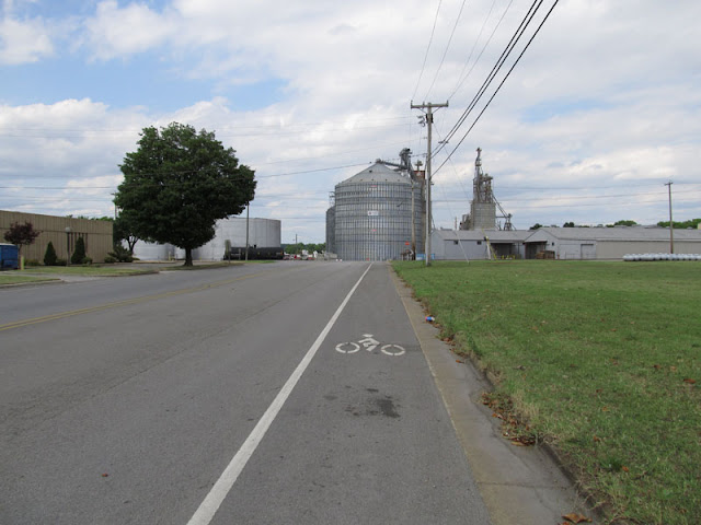
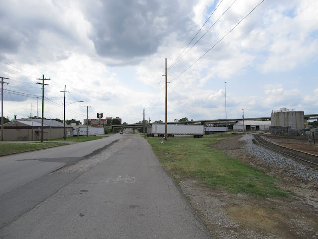
Matt got the seat switched and after a few adjustments, we took off looking for the bike trail. We located it soon enough, way down the street toward 6th Avenue from the east end of the park. I took the lead and off we went. It was a winding route, crossing streets and disappearing at times to pick up on the other side of an adjacent road. It was the most convoluted route, I would have been terrified to be out there with the kids, though the traffic was not too bad. There was ONE sign on a post and many faded bike symbols on the ground randomly along the small lane that ran along the main road. It was not hard going, but the lane was chock full of gravel and broken glass in many places, we had to go easy.
Once we covered the first 2 miles or so, the route moved away from the main road to a wide path of its own. We biked along enjoying ourselves and soon enough, entered Point Mallard Park where the path kept going right to the campground and through it. It merged with a campground road for about a city block of distance and then made a 90 degree turn to the left and kept going as a hard-packed gravel road that eventually met up with the hiking/biking loop that goes along the river beside the golf course.
We stayed on the path until it merged back with the closed paved road that loops Point Mallard Park and it came out back on Point Mallard Parkway, merging with itself at the parking area by the golf course. We headed back to the van parked up at Rhodes Ferry, getting back was not AS fraught with confusion as the initial ride out, but it was still pretty darn confusing. The worst spot is one point when the bike route ends at an intersection and then starts up at the diagonal corner. There's a TINY island in the middle of the intersection you bike over to and wait for the light to change so you can bike over to the other corner, the two of us barely fit and that light changes after about 5 seconds.
Here is our track route:
https://maps.google.com/maps/ms?msa=0&msid=201161553481579122004.0004c185261020d944c43
I can't find an actual map or any information from the City of Decatur about the bike trail anywhere now. There was a HUGE push back in 2007 or so to get it built and since then, I don't think anyone in office even remembers it's there.
It's about half and half paved and gravel. The gravel was all easy pedaling except for one short stretch that was like going through soft sand.
Along Point Mallard Parkway, the bike path runs next to the main road, but with a nice median.
It moves further away from the road as it heads west toward Rhodes Ferry Park.Finally, it turns away from the main road and winds all by itself between two huge industrial complexes.
Ahhhh, how I love this seat! I can't tell how durable it will be, I am hoping it will hang in there at least a year or two.
Here is where it starts to merge back with the mess of turns and roadways in the industrial part of town.
It joins up with the roadway for maybe a mile stretch, there are intersections and crossings along this section.Then it moves back to it's own pathway again for another half mile or more.
Then back to being part of the road again!
The pathway ends just on the other side of the overpass off in the distance. Rhodes Ferry Park is within sight of the terminus. In all, we biked 11.25 miles, it took about 2 hours with a few stops to adjust the seat and have a short break about half way.


